
What Satellites See When Aid Runs Out
By: Monica Adjei | October 5, 2026
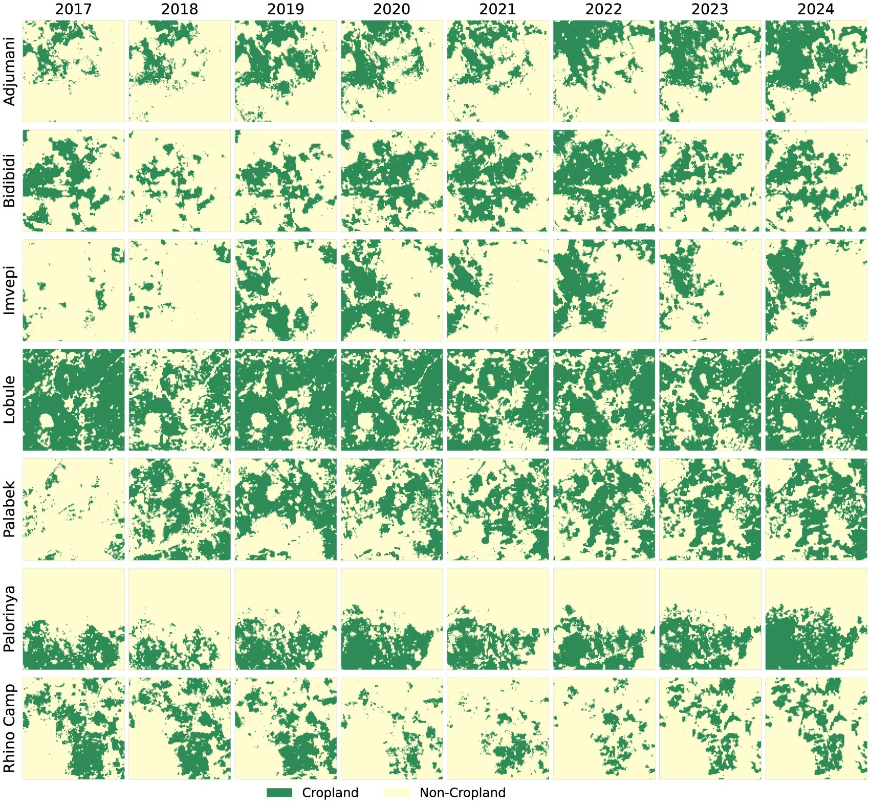
What can satellites reveal about how farmland shifts across a region hosting nearly two million refugees? A new open-access study in Environmental Research Letters, led by our PhD student Abena Boatemaa Asare-Ansah as her first lead-authored paper, sets out to map exactly that.
The problem she set out to solve starts with an obvious blind spot: ordinary satellite maps tend to miss smallholder farming. Africa’s small, scattered fields blend into the surrounding landscape, so standard maps often under- or overcount active farmland altogether. That is worse for refugee-hosting areas, where decisions about land and food aid depend on an accurate picture of what’s actually on the ground. To see more clearly, the team used Google’s 10-meter AlphaEarth embeddings to map cropland year by year across seven refugee settlements in northern Uganda from 2017 to 2024.
What the maps reveal is a landscape in constant motion. Farmland expanded through the late 2010s, dipped in 2020 coinciding with COVID-19 and flood disruptions, peaked at ~447,810 hectares in 2022, then fell by roughly half by 2024 (~223,100) as cuts to humanitarian aid collided with regional drought. The patterns beneath those shifts are just as telling: farming clustered close to settlements and rose and fell with rainfall, while more crowded settlements showed less cropland — a sign of growing land pressure. Over the same period, food insecurity among refugee households climbed from about 37% to 68%.
Taken together, the study offers a clear, year-by-year view of how quickly livelihoods adapt and shift under pressure. But as Dr. Catherine Nakalembe reflected in her LinkedIn post on the paper, a map and data alone do not equal better policy. A precise model only matters if governments and humanitarian organizations act on it by protecting communities, securing land access, and providing direct aid where it’s needed most. The hope is that this research gives them a clearer and more informed foundation to do just that.
Read the open-access paper here: “Mapping agricultural dynamics in displacement-affected landscapes using satellite foundation model embeddings” in Environmental Research Letters (2026). Abena Boatemaa Asare-Ansah, Jamon Van Den Hoek, Adebowale Daniel Adebayo, Xiao-Peng Song, and Dr. Catherine Nakalembe.
